The Las Chorreras Geo-Route is a circular route of approximately 13 kilometres in length, well-defined on the terrain, with some hills but bearable.
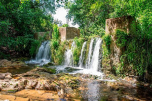
The aim is to reach Las Chorreras, an area where underground water from a spring emerges. This spring is so powerful that it is the source of the water that supplies Las Navas. The limestone terrain has provided cavities that store the water that percolates through the ground.
HOW ARE THE SPRINGS FORMED?
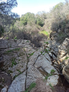
They are springs on the banks of the river Ciudadeja, which have generated large deposits of limestone outlets over the last few years.
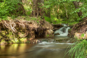
The origin of Las Chorreras is due to the existence in the subsoil of several faults that allow the groundwater to flow towards the surface, and partly shape the morphology of the terrain. These waters continue to generate large deposits of travertine (calcareous tuffs), due to which they are dissolved by the loss of pressure in the waterfalls, around the roots of trees and other remains of the abundant riverside vegetation.
These rocks are very characteristic, with a multitude of holes and tubes, generated when the roots and branches rot and disappear, leaving only the carbonate coatings.
HOW TO GET THERE
The starting point is about 300 metres from the road exit towards San Nicolás del Puerto, after completing the route along the road towards the entrance to the Cuesta de Manolo path, where we have to go through the gate. The path is public but the estate is private, so we have to leave the gate as we find it.
We take this path to the Ribera de Ciudadeja. A little before reaching the watercourse, take a gate on the right hand side and leave it as you find it.
Parallel to this, we go up the watercourse to the area that gives its name to the route, Las Chorreras. Once there, we return along the same route to the path that takes us to the Molino de los Frailes. From this point, the route continues to the hermitage of the Virgen de Belén where Las Navas celebrates its pilgrimage and finally, returns to the village along the Camino del Túnel. This path is so called because the vegetation envelops the space and forms a hollow through which to pass.
The route is signposted with directional beacons and panels explaining the main geological landmarks and buildings of interest, such as mills, water intakes, etc.
This new route joins the increasingly important network of footpaths in our municipality, which undoubtedly contributes to the increase in tourism that has been observed in recent years, from which the whole town benefits directly or indirectly.
It is recommended to bring water and suitable clothing and footwear, protection from the sun, a cap, hat, long sleeved clothes and trousers, it is also very important to wear sun cream.
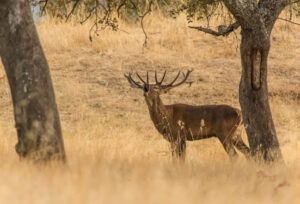
TEMPORARY ATTRACTION
Throughout the route you will also be able to enjoy La Berrea (the rutting season). The rutting season begins in September and ends in October. For most of the year, the deer usually live alone in the forest, separated from the females who live in herds. At the end of summer, the males approach the groups of females and the ritual of conquest begins.